
The short answer
- A legal description identifies a parcel on the deed; a street address or a tax parcel number does not.
- The three US systems are lot and block (a recorded plat), the PLSS (section, township and range) and metes and bounds.
- Metes are the distances and bearings; bounds are the boundaries and monuments they run between.
- The PLSS describes land by section, township and range; a section is 1 square mile, 640 acres.
What is a legal description of property?
A legal description of property is the wording in a deed that identifies the parcel so exactly that a surveyor can find its boundary on the ground. A street address can change and a tax parcel number is only an index. The legal description is what the deed conveys, and it is what title companies, lenders and courts rely on.
It is written in one of three systems, or a mix of them. Which one depends on where the land is and how it was first divided.
| System | How it describes land | Where it is used |
|---|---|---|
| Lot and block | A lot number on a recorded subdivision plat | Subdivisions in every state |
| PLSS (township and range) | Parts of a numbered section in a township and range | 30 public land states, mostly in the Midwest, South and West |
| Metes and bounds | Bearing and distance of each side, from a point of beginning | The original colonies, Texas, Kentucky, Tennessee and other non-PLSS states; irregular parcels everywhere |
What does a legal description of property look like?
A legal description of property looks like one formal sentence or paragraph near the start of the deed, usually after the words “the following described land”. How it reads depends on the system. These made-up examples show one of each:
| System | Example |
|---|---|
| Lot and block | Lot 7, Block 3, Oak Hill Subdivision, according to the plat recorded in Plat Book 12, Page 45, of the county records |
| PLSS | The NE ¼ of the SW ¼ of Section 12, Township 3 North, Range 4 West of the Fifth Principal Meridian |
| Metes and bounds | Beginning at an iron pin on the north line of Elm Road; thence N 45° E 200.00 feet; thence S 45° E 150.00 feet; thence S 45° W 200.00 feet; thence N 45° W 150.00 feet to the point of beginning |
Real descriptions are often longer. They add the county and state, easements and exceptions (“less and except the west 10 feet”), and sometimes a second system as a check, such as a lot that is also described by metes and bounds.
What is a lot and block legal description?
A lot and block legal description names a lot on a subdivision plat that has been recorded with the county. When land is subdivided, a surveyor draws every lot with its dimensions, and the plat is filed in a plat book. From then on, the deed only has to point to it, as in “Lot 7, Block 3, Oak Hill Subdivision, according to the plat recorded in Plat Book 12, Page 45” (a made-up example).
To read one, find the plat by its book and page at the county recorder. The plat shows:
- The block, a group of lots usually bounded by streets, and your lot number inside it. Lot numbers often restart in each block.
- Each side’s length and bearing, the lot area and the street frontage.
- Easements and building setback lines, usually as dashed strips.
The plat holds the metes and bounds of each lot, so a lot and block description is as precise as the plat it points to. Most homes in subdivisions are described this way.
What is the PLSS (township and range)?
The Public Land Survey System (PLSS) describes land by its place in a grid of townships, ranges and sections, measured from a principal meridian and a baseline. A township is a square 6 miles on each side, numbered north or south of the baseline. A range is its column, numbered east or west of the meridian. Each township holds 36 sections of 1 square mile, numbered 1 to 36 starting in the northeast corner.
| Unit | Size | Acres |
|---|---|---|
| Township | 6 × 6 miles, 36 sections | 23,040 acres |
| Section | 1 × 1 mile | 640 acres |
| Quarter section | ½ × ½ mile | 160 acres |
| Quarter-quarter section | ¼ × ¼ mile | 40 acres |
A PLSS description reads from the smallest part to the largest, so read it backward to find the land: “the NE ¼ of the SW ¼ of Section 12, Township 3 North, Range 4 West” means find the township and range, then section 12, then its southwest quarter, then the northeast quarter of that. The result is 40 acres.
In PLSS states, a parcel that doesn’t follow the grid is described by metes and bounds, usually starting from a section corner. Lot and block is used there too, for subdivisions.
What is a metes and bounds legal description?
A metes and bounds legal description traces the parcel’s boundary side by side. Metes are the distances and bearings of each side; bounds are the boundaries and monuments the line runs between, such as iron pins, roads, streams or a neighbor’s land. It starts at a point of beginning and must return to it.
It is the oldest of the three systems and the main one in the original colonies and in states such as Texas, Kentucky and Tennessee. To read the calls one by one, check that a description closes and plot it, see metes and bounds.
How do you find the legal description of your property?
You find the legal description of your property on your deed, which is recorded with the county recorder (register of deeds). Other places that carry it:
- Your closing papers, including the deed and the title insurance policy.
- The county recorder’s office or website, searched by your name or the seller’s.
- A survey of the property, which states the description it measured.
- The county tax record, which often shows a shortened description. Use the deed, not the tax record, for anything legal.
A title company or a real estate attorney can also pull the deed for you. There is no lookup in AreaPal: the county’s records are the source.
Can you map a legal description yourself?
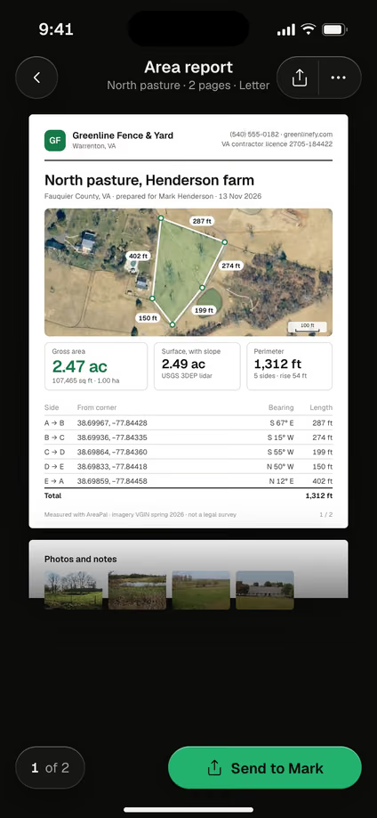
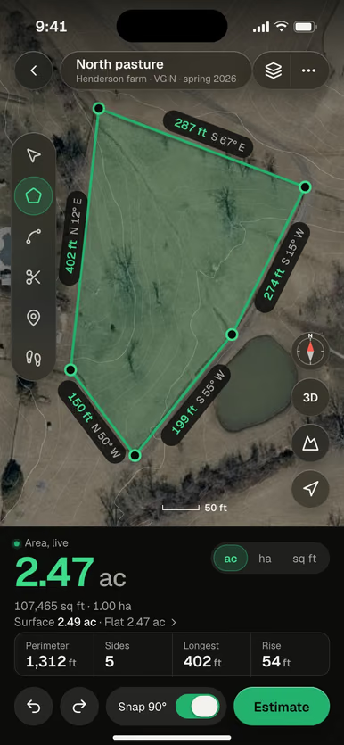
You can sketch a legal description yourself for planning, but only a licensed surveyor can locate it on the ground. AreaPal doesn’t show property lines or parcel data. It measures what you trace on a satellite map or walk with GPS (see how to measure land), and its area report lists each traced side with a bearing and length, so you can hold it up against the deed’s calls.
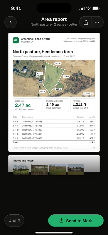
The area report lists each side of a traced shape with its bearing and length, in the same form as a deed’s calls. It is marked as not a legal survey.
If the sketch and the deed disagree, the deed and the surveyor win. To find the pins that mark your corners, see how to find property lines.
 Compare your sketch with the deedTrace your land in AreaPal and check each side's length and bearing against the calls in your deed.

Questions
Is the parcel number the legal description?
No. The tax parcel number (APN or PIN) is an index number the county assessor uses for taxes. The legal description is the wording in the deed, and the tax record often shows only a shortened version of it.
What is an abbreviated legal description?
An abbreviated legal description is a shortened version, such as the lot, block and subdivision name, used on tax bills and some forms. It is not a substitute for the full description in the deed.
Can I search for a property's legal description online?
Many county recorders and assessors let you search their records online by owner name, address or parcel number, and the recorded deed shows the full description. Some charge a small fee for copies.
Can a legal description be wrong?
Yes. Typing errors, calls that do not close or descriptions that overlap a neighbor's can happen. A surveyor can find the problem, and an attorney or title company can fix it with a corrective deed.
Sources: US Bureau of Land Management, Manual of Surveying Instructions (2009): township 6 × 6 miles, 36 sections of 1 square mile (640 acres); USGS, the Public Land Survey System covers 30 states; NIST Handbook 44, Appendix C (acre = 43,560 sq ft). The lot and block, PLSS and metes and bounds examples are made up for illustration. Explainer only: for a specific deed, ask a licensed surveyor or a real estate attorney.


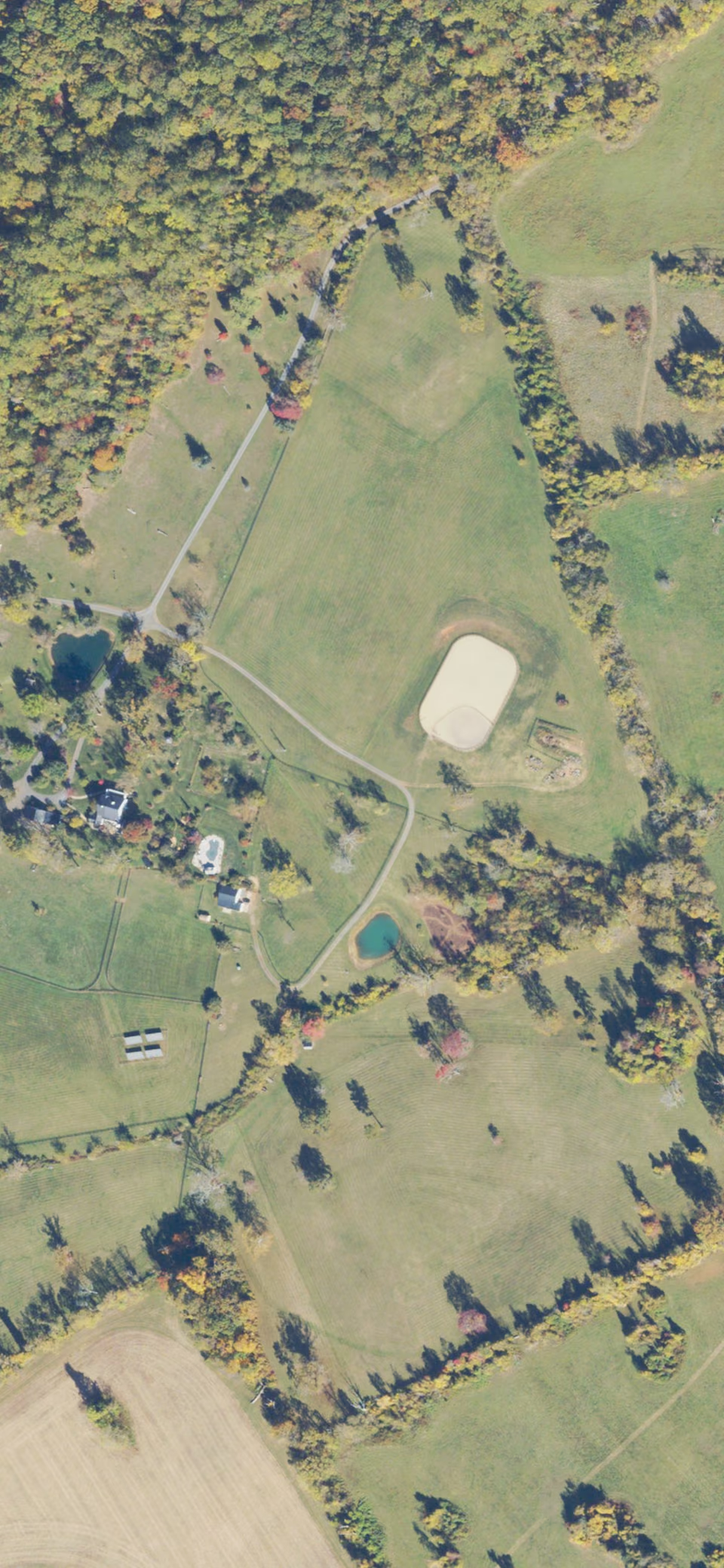 Imagery USDA NAIP 2023
