
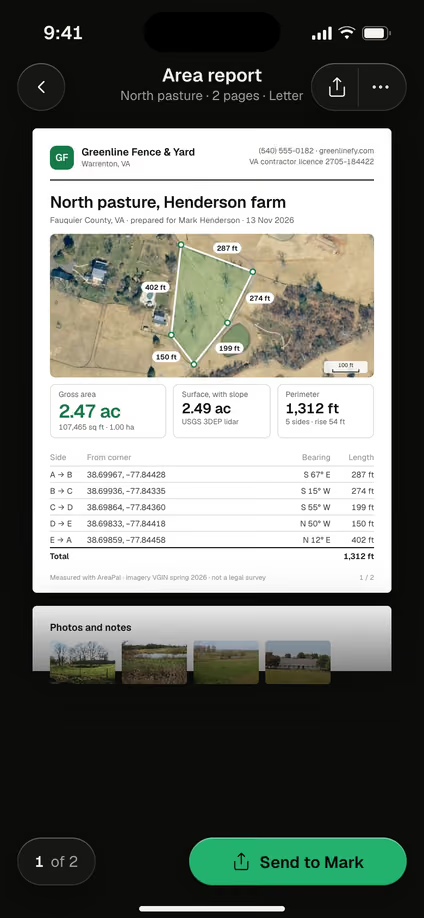
The short answer
- Metes are the distances and bearings of each side; bounds are the boundaries and monuments, such as iron pins, roads and streams, that the line runs between.
- A metes and bounds description starts at a point of beginning (POB) and must return to it.
- It is one of three US systems, with the rectangular survey (PLSS, township and range) and lot-and-block plats.
- Only a licensed surveyor can locate a description on the ground; a sketch from the calls is for planning.
What is metes and bounds?
Metes and bounds is a way of describing land by tracing its boundary from corner to corner, with the length and direction of every side. Metes are the measures: each side’s distance and its bearing. Bounds are what the line runs along and between: monuments such as iron pins, concrete markers and stones, natural features such as a creek or a ridge, and roads or a neighbor’s land.
It is the oldest of the three US systems. It came from English practice, and land in the original colonies and in states such as Texas, Kentucky and Tennessee, which were never part of the federal grid survey, was first described this way. Wherever land is split into shapes that don’t follow a grid or a plat, it is still in use.
How do you read a metes and bounds call?
You read a metes and bounds call as one straight side of the parcel: a bearing that gives its direction, a distance that gives its length, and usually the monument at its far end. Each call starts with “thence”, meaning from the corner the previous call ended on.
A bearing always starts with N or S, gives an angle from 0 to 90°, and ends with E or W. N 36° 52′ 12″ E means face north, then turn 36 degrees, 52 minutes and 12 seconds toward the east. A degree has 60 minutes (′) and a minute has 60 seconds (″).
| Part | Example | What it means |
|---|---|---|
| Thence | thence | From the corner the last call ended on |
| Bearing | N 36° 52′ 12″ E | Direction of the side, measured from north or south toward east or west |
| Distance | 300.00 feet | Horizontal length of the side |
| Bound | along Mill Road | What the side follows: a road, a stream, a neighbor's line |
| Monument | to an iron pin set | The marker at the corner the call ends on |
Older deeds often give distances in chains (66 ft) or rods (16.5 ft), and some calls follow a curve, with a radius and an arc length instead of a single bearing. For the old units, see land measurement units.
What is an example of a metes and bounds description?
Your own description is in your deed, recorded with the county recorder. Here is a short metes and bounds description of a four-sided parcel. It is made up for this guide, but it is written the way a real deed reads:
Beginning at an iron pin found at the corner of Mill Road and Cedar Lane, the point of beginning; thence along Mill Road N 36° 52′ 12″ E 300.00 feet to an iron pin set; thence along the land now or formerly of Jones S 53° 07′ 48″ E 250.00 feet to a stone; thence S 53° 07′ 48″ W 200.00 feet to an iron pin on Cedar Lane; thence along Cedar Lane N 82° 14′ 05″ W 222.04 feet to the point of beginning, containing 1.22 acres, more or less.
Each call can be split into how far it goes north or south and how far it goes east or west. Those two parts are how surveyors check a description:
| Call | Bearing and distance | North (+) or south (−) | East (+) or west (−) |
|---|---|---|---|
| 1 | N 36° 52′ 12″ E 300.00 ft | +240.00 ft | +180.00 ft |
| 2 | S 53° 07′ 48″ E 250.00 ft | −150.00 ft | +200.00 ft |
| 3 | S 53° 07′ 48″ W 200.00 ft | −120.00 ft | −160.00 ft |
| 4 | N 82° 14′ 05″ W 222.04 ft | +30.00 ft | −220.00 ft |
| Total | 972.04 ft around | 0.00 ft | 0.00 ft |
Both columns add up to zero, so the description closes on its start. The parcel it encloses is 53,100 sq ft, or 1.22 acres (4,933 m²).
What is the point of beginning?
The point of beginning (POB) is the corner where a metes and bounds description starts and where its last call must end. It is fixed to something that can be found again: a monument, a road intersection, or a section corner in PLSS states.
Some descriptions reach the POB from a distant known point first: “Commencing at the northeast corner of Section 12, thence … to the point of beginning.” Those commencing calls only locate the start. They are not part of the boundary, so don’t count them when you add up the sides.
What does closure mean in a metes and bounds description?
Closure means the calls of a metes and bounds description lead back exactly to the point of beginning. You check it the way the table above does: for each call, the north-south part is the distance × the cosine of the bearing angle, and the east-west part is the distance × its sine. If both columns add up to zero, the description closes.
Rounding bearings to the second leaves a tiny gap; the example above closes to within 0.01 ft. A gap of feet means something is wrong: a mistyped bearing or distance, a call left out, or an N written for an S. A surveyor or the title company resolves it, sometimes with a corrective deed.
How is metes and bounds different from lot and block and PLSS?
Metes and bounds traces the boundary itself, while lot and block points to a lot on a recorded plat and the PLSS (township and range) points to a square in a national grid. Many deeds mix them, for example a metes and bounds parcel that starts from a PLSS section corner.
| System | Describes land by | Shapes it makes | Where it is used |
|---|---|---|---|
| Metes and bounds | Bearing and distance of each side, from a point of beginning | Any shape, often following streams, ridges and old roads | The original colonies, Texas, Kentucky, Tennessee and other non-PLSS states; irregular parcels everywhere |
| Lot and block | A lot number on a recorded subdivision plat | Subdivision lots | Subdivisions in every state |
| PLSS (township and range) | Parts of a numbered section in a township and range | Squares and rectangles on a grid | 30 public land states |
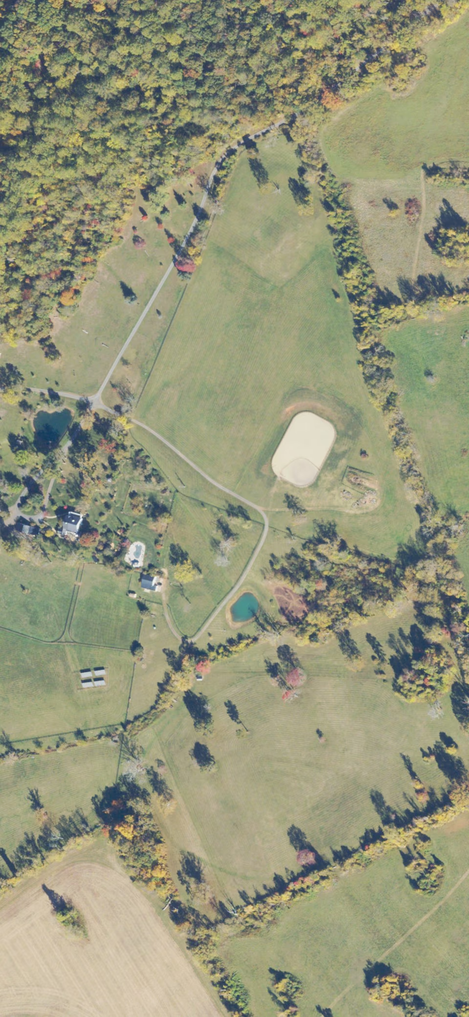
Seen from the air, the difference is easy to spot: metes and bounds land is a patchwork of irregular fields, while PLSS land is laid out in square-mile sections. For the other two systems in depth and where to find your own deed’s wording, see legal description of property.
How do you plot a metes and bounds description?
You plot a metes and bounds description by drawing each call in turn from the point of beginning, either by hand with a protractor and a scale or by turning the calls into coordinates. By hand:
- Pick a scale on graph paper, such as 1 inch = 50 ft, draw a north arrow and mark the POB.
- Draw each call. Set the protractor on the north or south line at the corner, turn the angle toward east or west, and draw the side to scale.
- Check the end. The last side should land on the POB. If it misses by a lot, recheck each call before blaming the deed.
- Or work it out in numbers. Split each call into its north-south and east-west parts, as in the example table, and add them up corner by corner. That gives every corner’s position measured from the POB.
Surveyors and title examiners use deed-plotting software that does the same thing from the calls. Whichever way you plot it, a drawing shows the shape the deed describes, not where it sits on the ground. Old bearings may be measured from magnetic north, and a survey states its own basis of bearings, so only a surveyor can tie the drawing to the corners on the land.
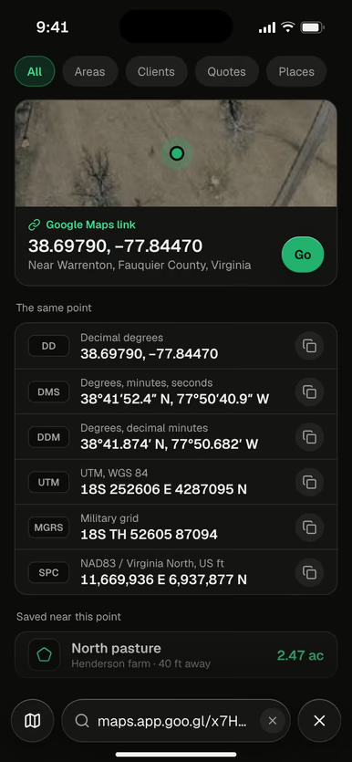
AreaPal doesn’t show property lines or parcel data: it measures what you trace on a satellite map or walk with GPS, and it does not plot a description from its bearing and distance calls. It can build a shape from corner coordinates you type, in latitude and longitude, DMS, UTM, MGRS or another system by its EPSG code, so a survey that lists coordinates for its corners can be entered directly. You can also trace the land on the satellite map and type a side’s exact length to match the deed. Both give a sketch for planning and estimates. For every way to measure, see how to measure land.
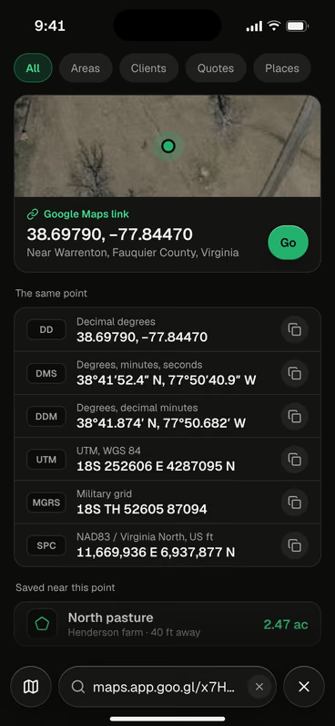
A shared Google Maps link opened as coordinates, shown in decimal degrees, DMS, UTM and MGRS. Corners typed for a shape can use the same formats.
Why do surveyors still use metes and bounds?
Surveyors still use metes and bounds because it can describe any shape, and because in the states outside the PLSS it is the original description of most land. It is also how a parcel is cut from a larger tract, how an easement strip is described, and what a subdivision plat records for each lot.
The monuments matter as much as the numbers. When a monument and a measured distance disagree, courts in many states give the original monument more weight, which is why a surveyor retraces the corners on the ground instead of only redrawing the calls. To find the pins on your own land, see how to find property lines, and for what a survey costs, land survey cost.
 Sketch the parcel for planningType the corners' coordinates or trace the land in AreaPal, then check each side against the deed.

Questions
What is a metes and bounds description?
A metes and bounds description is the paragraph in a deed that traces the parcel's boundary call by call, giving the bearing and distance of each side and the monument at each corner. It starts and ends at the point of beginning.
What does "thence" mean in a metes and bounds description?
Thence means "from that point". Each call begins with it, so every bearing and distance is measured from the corner the previous call ended on.
What is a metes and bounds survey?
A metes and bounds survey is a boundary survey that describes the land by the bearing and distance of each side, starting and ending at the point of beginning. A licensed surveyor writes it, and it can become the legal description on a deed.
Can AreaPal plot a metes and bounds description?
No. AreaPal does not read bearing and distance calls or show property lines. It can build a shape from corner coordinates you type, such as those listed on some surveys, and the result is a sketch for planning, not a boundary.
Sources: US Bureau of Land Management, Manual of Surveying Instructions (2009): PLSS townships and sections; USGS, the Public Land Survey System covers 30 states; NIST Handbook 44, Appendix C (acre = 43,560 sq ft; chain = 66 ft; rod = 16.5 ft). The metes and bounds description, its bearings and its area are made up for illustration and computed for this guide. Explainer only: for a specific deed, ask a licensed surveyor or a real estate attorney.
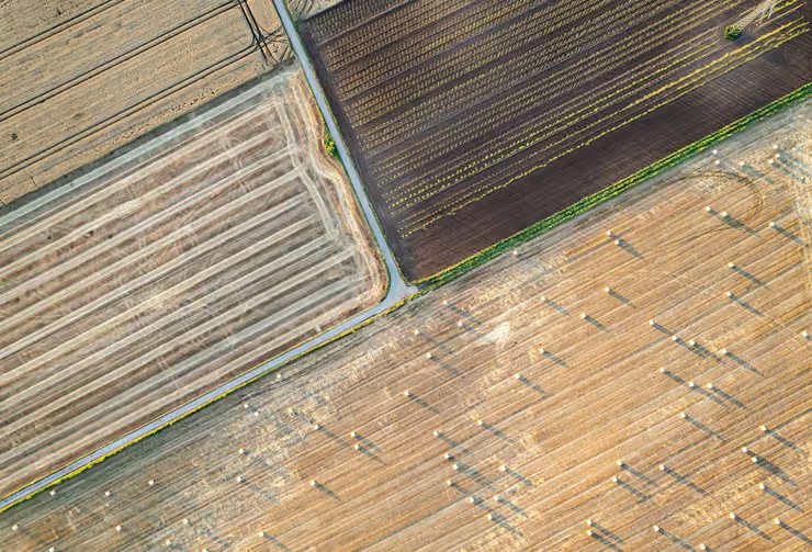

 Imagery USDA NAIP 2023
