
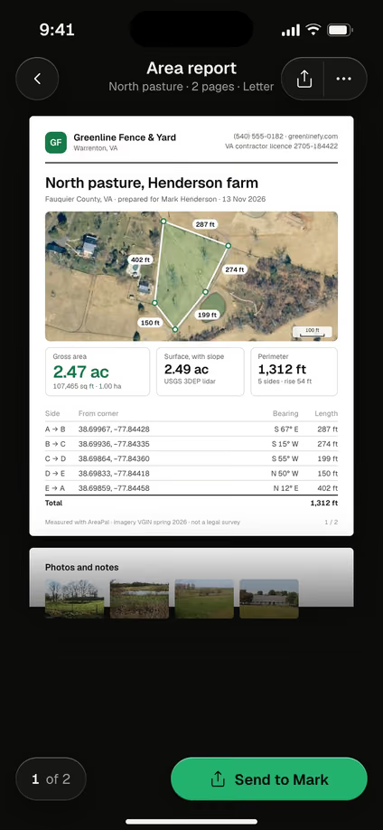
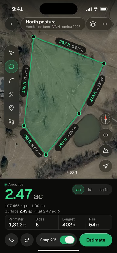
The short answer
- A residential boundary survey costs $400 to $700 (This Old House, 2026); Fixr gives $400 to $1,000 for up to 1/2 acre (2025).
- A boundary survey marks the legal lines; a mortgage or location survey does not set corners.
- Price depends on acreage, terrain and trees, the records available and the region.
- Measuring land yourself is for planning and estimates, never for legal boundaries.
What is a land survey?
A land survey is a licensed surveyor’s measurement of a property, delivered as a signed and sealed drawing that shows the boundary, the corners and what sits on the land. The surveyor researches the deed, the plat and neighboring records, measures in the field, and finds or sets corner pins. Surveyors are licensed by each state’s board of land surveyors, and the license number appears with the seal on every survey they sign.
Not every survey marks the lines. A boundary survey establishes the legal property lines and sets or confirms the corner pins. A mortgage or location survey shows where the house and improvements sit relative to the recorded lines for a lender, but does not set corners, so it is not enough to place a fence.
How much does a land survey cost?
A residential boundary survey costs $400 to $700, according to This Old House (2026), and Fixr gives $400 to $1,000 for a single boundary survey of up to half an acre (2025). These are what a licensed surveyor charges the customer for a home lot; other survey types and larger parcels are priced on their own.
| Job | Typical cost | Source |
|---|---|---|
| boundary surveyStandard residential boundary survey; average $525 | $400–$700 per survey | This Old House, April 2026 |
| land survey (single boundary, <=1/2 acre)Single boundary, up to 1/2 acre; national average $600 | $400–$1,000 per survey | Fixr, January 2025 |
What a contractor charges the customer. US, read November 2026. Not AreaPal's price.
The survey types differ in what you get, and so in price. We could not check a current price for each type, so ask the surveyor to quote the one you need:
| Survey type | What you get |
|---|---|
| Boundary survey | Legal lines located, corner pins found or set |
| Mortgage or location survey | House and improvements shown against the lines; no corners set |
| Fence survey | The line marked for a new fence |
| Topographic survey | Ground contours and elevations, trees, structures |
| Elevation certificate | Building elevation for flood insurance |
| ALTA/NSPS survey | Detailed survey for commercial deals and title insurers |
| Subdivision | Splitting a parcel into new lots |
How much does a property line survey cost?
A property line survey is a boundary survey, which costs $400 to $700 for a standard residential lot, according to This Old House (2026). Fixr gives $400 to $1,000 for a single boundary survey of up to half an acre (2025). Both ranges are for boundary surveys of a home lot, the first a standard residential survey and the second a single boundary of up to half an acre, so ask surveyors to quote a boundary survey with the corners found or set and flagged.
What you pay within that range depends on the same things as any boundary survey: how much land, how many corners, whether the old pins are still in the ground and how good the records are. A mortgage or location survey is not the same thing: it does not mark the lines, so it won’t tell you where a fence can go.
How much does a survey cost per acre?
A survey of more land costs more in total, but usually less per acre. Small lots are often priced as a flat fee, and Fixr’s range above is for up to half an acre. On larger land the cost per acre drops, because the research and setup do not grow as fast as the area. To picture parcel sizes, see how big an acre is.
What makes a land survey cost more?
A land survey costs more when the parcel is larger or oddly shaped, the ground is steep or wooded, the records are poor, or the surveyor has far to travel. These are the main drivers:
- Acreage and shape. More corners and longer lines mean more fieldwork.
- Terrain and vegetation. Hills, dense trees and underbrush slow the crew down.
- Records. A recent survey and intact corner pins lower the cost; missing pins and old, vague deeds raise it.
- Region. Prices differ between states and between city and rural areas.
- Timing. Rush jobs and bad-weather seasons often cost extra.
Recertifying an existing survey for a new buyer usually costs less than a new one, so ask whether an earlier survey can be updated.
How do you estimate the cost of your own survey?
You estimate your own survey cost by starting from the boundary survey range above, then adjusting for the survey type, the parcel’s size, terrain and records. A half-acre suburban lot with pins still in place and a recent plat sits near the low end. Ten wooded, hilly acres with a deed from the 1950s and no pins sits near the high end.
- Find your acreage on the deed, the plat or the tax record, or measure it on a map.
- Pick the survey type you actually need: a boundary survey to mark lines, a mortgage survey for a lender, a topographic survey for design work.
- Start from the range for a home lot, then move up for more land, trees, slopes or missing records.
- Get two or three written quotes from licensed surveyors near the land. Local prices beat any national average.
When do you need a land survey?
You need a land survey before building on or near a property line, fencing a disputed edge, subdividing land, or settling a boundary dispute with a neighbor. Lenders and title companies may also ask for one when you buy. In a flood zone, an elevation certificate may be needed for flood insurance.
For a quick check of where your lines should be before you call anyone, see how to find property lines.
What does a land survey look like?
A land survey looks like a scaled drawing of the property: its outline with each side’s length and bearing, the corner pins, the buildings, fences and driveways, the easements, and the surveyor’s signature, seal and license number. On the ground, you will see new or flagged pins at the corners and, sometimes, wooden stakes with colored ribbon along the lines.
The bearings and distances on the drawing match the calls in the deed. To read them, see metes and bounds, and for the other ways a deed can describe land, legal descriptions of property.
Can you measure land yourself instead of hiring a surveyor?
You can measure land yourself for planning, buying materials and pricing a job, but not to set a legal boundary. A tape, a measuring wheel or a satellite map gives you the size and the side lengths. Only a licensed surveyor’s work counts for a sale, a permit or a dispute.
AreaPal doesn’t show property lines or parcel data. It measures what you trace on a satellite map or walk with GPS, and the area report it makes says plainly that it is not a legal survey. For each method and how accurate it is, see how to measure land.
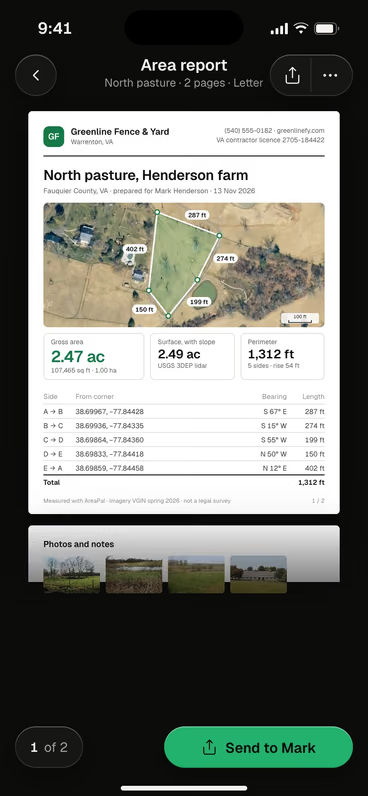
The area report lists the area, the perimeter and every side’s length. It is a planning document, and it says so on the page.
 Measure it for planningTrace or walk your land in AreaPal to size a fence, a lawn or a gravel drive before the survey comes back.

Questions
Who pays for a land survey when buying a house?
The buyer usually pays when the lender or title company asks for a survey, but local custom and the purchase contract decide. Ask before closing whether an existing survey can be recertified instead.
How much does a survey for a fence cost?
Marking a line for a fence is boundary survey work: This Old House gives $400 to $700 for a standard residential boundary survey (2026), and Fixr $400 to $1,000 for a single boundary of up to half an acre (2025). It is cheaper when the corner pins are already in place and only need to be found and flagged.
How do I get a copy of my land survey?
Look in your closing papers, then ask your title company, the surveyor who did it or the county recorder if it was recorded. Some surveys are held only by the surveyor and the owner at the time.
Is a plat the same as a survey?
A plat is the recorded map of a subdivision showing every lot; a survey is a licensed surveyor's measurement of one property. A survey often refers to the plat, but only the survey shows what is on the ground today.
Sources: Typical costs, what a surveyor charges the customer (US): This Old House, Land survey cost (updated April 6, 2026); Fixr, Land survey cost (updated January 31, 2025). Read November 2026. Local prices vary with region and parcel; get written quotes from licensed surveyors. Not AreaPal prices.
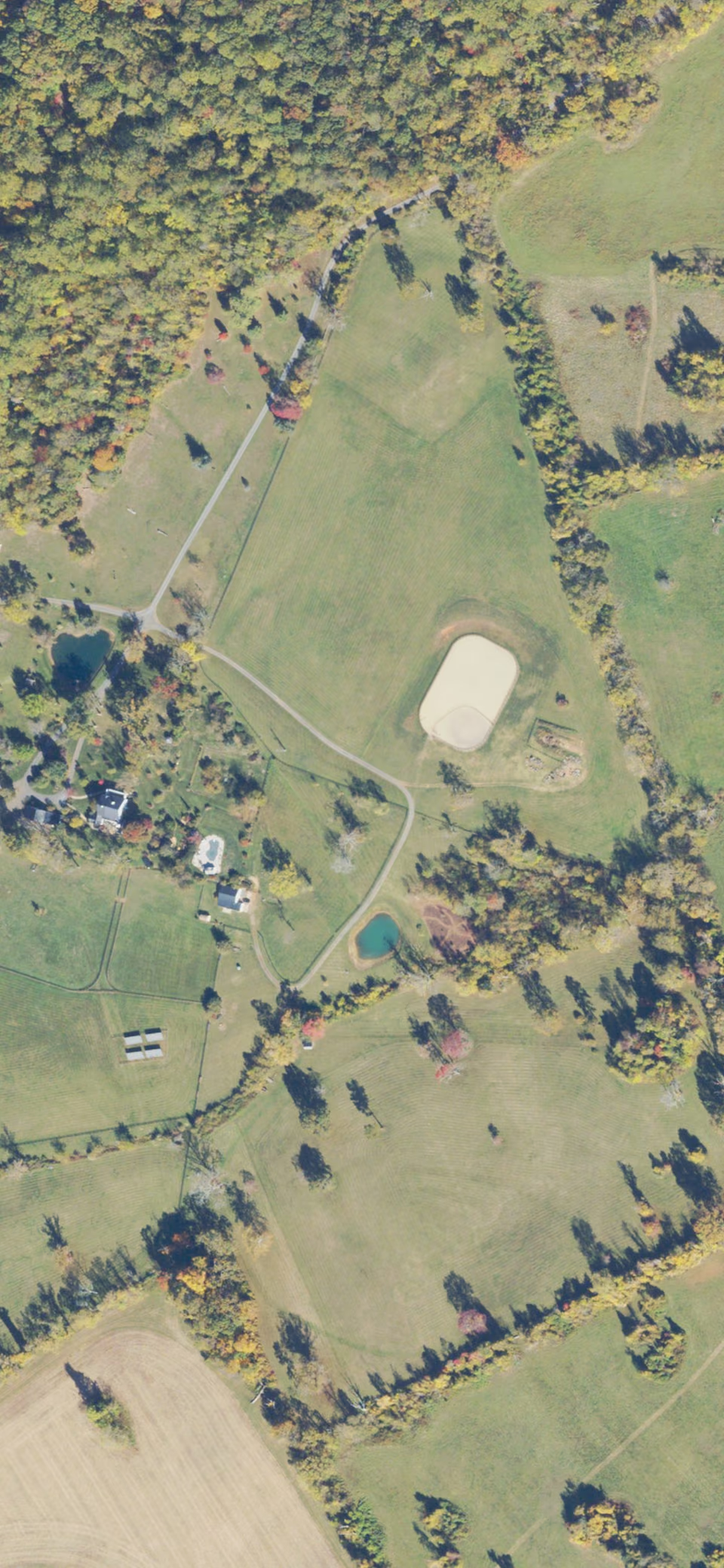 Imagery USDA NAIP 2023
